Brancaster Beach

Combined Shape Created with Sketch.

Brancaster beach with its wide expanse of golden sands is perfect for Summer sandcastles or Winter wanders, even on the busiest of days there is room to find your own space and get lost in its tranquil calm.

Brancaster Beach

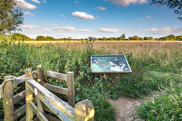
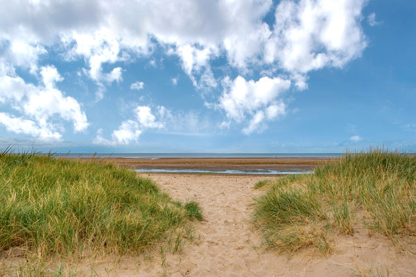
From the Hunstanton direction, the further around the West Norfolk coast you go, you will discover the quieter pleasures on Brancaster beach, with its natural dunes. From the Wash, around the long coast of Norfolk, the sea gradually retreats, giving rise to sandbanks, spits of land and silted harbours. Brancaster at low tide shows wide expanses of mud, which are important feeding areas for many birds (much of the landscape now being managed by the National Trust) and a history of shellfish farming. For Brancaster today, sailing, fishing, and trips to see the seals are common pastimes for boat owners and visitors to the coast. There are mooring opportunities for small leisure craft at points along the Wash to aid avid sailors in their exploration of the coast. See the official Sail the Wash website (www.sailthewash.com) for more details.

Nearby Scolt Head Island is an offshore barrier island near Brancaster. The island is a National Nature Reserve comprising of sand dunes, salt marsh, intertidal sand and mud flats, and shingle. During Spring and Summer a ferry connects the island with the village of Burnham Overy Staithe, which is next to the creek-side Burnham harbour - a major recreational centre for sailing.

Site Information
Opening Times:
All times
Address:
Brancaster, King's Lynn, PE31 8AX, Norfolk
Visitor Information
Refreshments (nearby)
Yes
Toilets
Yes
Dog friendly
Yes
Features
Wildlife
Nearby Attractions
Attraction 1:
Branodunum Fort
route-icon
0.83 Miles Away
Branodunum is one of the eleven forts along the South and East coasts of England known as Saxon Shore Forts. The Romans built these forts during the 3rd century. At first they were used to protect and control shipping and trade around the coast; later they helped repel raiders from across the North Sea. They remained military garrisons for over 150 years before being abandoned when the Roman army withdrew from Britain.
View Venue
Attraction 2:
Church of St Mary the Virgin, Titchwell
route-icon
0.95 Miles Away
That there was a church at Titchwell at the end of the eleventh century is evidenced by Domesday, and much of the existing building dates from about that time. The tower is an interesting example of the many East Anglian eleventh century round towers.
View Venue
Attraction 3:
Titchwell Marsh
route-icon
1.5 Miles Away
Located on the north coast of Norfolk, between the villages of Titchwell and Thornham, Titchwell Marsh is blessed with diverse habitats that include reedbeds, saltmarsh and freshwater lagoons where avocets, bearded tits and marsh harriers nest. There is also a wide sandy beach here, which offers extensive views across The Wash.
View Venue
Attraction 4:
St. Mary's Church, Burnham Deepdale
route-icon
2.07 Miles Away
This little church in its coastal village deserves fame for its three outstanding features - it is Saxon round tower (pre-Conquest of 1066), its Norman font, and its collection of medieval glass.
View Venue
Attraction 5:
Holme Dunes
route-icon
3.55 Miles Away
At Norfolk’s northwest corner, where The Wash meets the North Sea, Holme Dunes is superbly located to attract migrating birds. It also holds a variety of important habitats which support numerous other wildlife species including natterjack toads, butterflies and dragonflies, as well as a large number of interesting plants.
View Venue
Group 3Created with Sketch. new arrowCreated with Sketch. Group 2Created with Sketch. new arrowCreated with Sketch. safetyCreated with Sketch. Group 7Created with Sketch. Combined ShapeCreated with Sketch.blue arrowCreated with Sketch. finishCreated with Sketch. F map pinCreated with Sketch. NO IMAGE AVAILABLE startCreated with Sketch. S