Sedgeford

Combined Shape Created with Sketch.

Sedgeford is situated about 3 miles south east of Hunstanton and is located in the Norfolk Coast Area of Outstanding Natural beauty.

Sedgeford

Sedgeford is situated about 3 miles south east of Hunstanton and is located in the Norfolk Coast Area of Outstanding Natural beauty.

The village lies in a fertile valley in the belt of chalk covering this area, with a small river running through it.

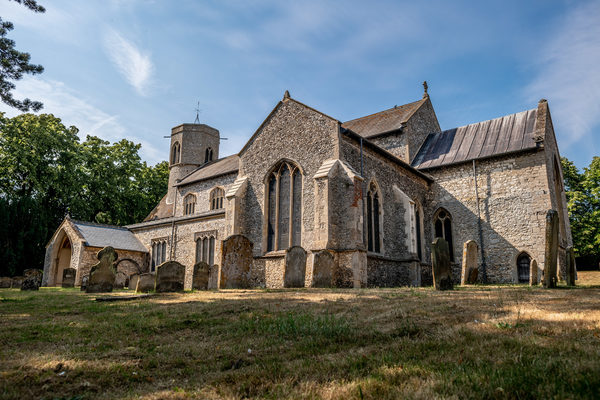
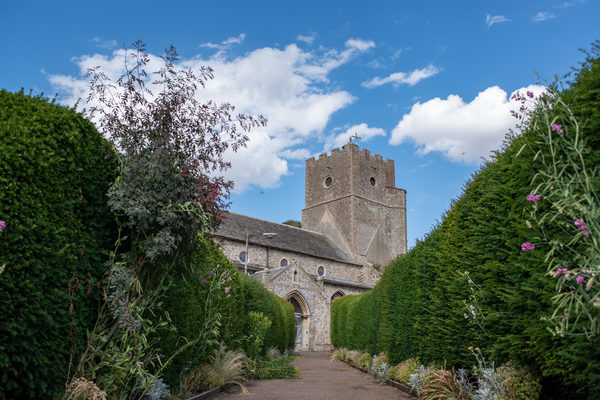
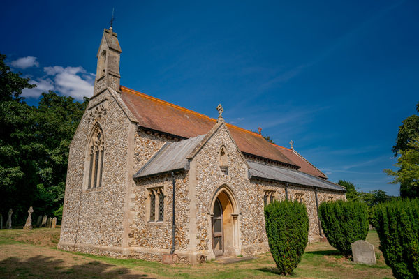
The village is recorded in the Domesday Book in 1086. Part of the church, built of flint and stone, is Anglo-Saxon in origin. Archaeological evidence shows that people have lived in the locality from much earlier times, with remains of Roman villas, pottery and a gold torc from the Iron Age and many earlier artefacts, like the Neolithic flint tools which are found in fields and gardens.

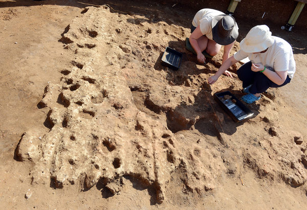
The Sedgeford Historical and Archæological Research Project (SHARP) was established in 1996 to reconstruct the story of human settlement in the parish. This on-going project is one of the largest independent archaeological projects in Britain and firmly rooted in the

local community.

The village has a church, St Mary’s, and a thriving village hall and recreation ground, containing a children’s playground and outdoor adult gym equipment. The village pub is the King William IV.

National cycle route 1 passes through the village and the Peddars Way passes just outside the village.

Site Information
Telephone:
Address:
Sedgeford, Hunstanton, PE36 5LU, Norfolk
Features
Heritage
Nearby Attractions
Attraction 1:
Church of St Mary the Virgin Sedgeford
route-icon
0.05 Miles Away
There has been a church on this site for over 900 years. In 1205 the church was appropriated to Norwich Cathedral Priory. It is during the Priory's period of responsibility that the church was eventually rebuilt from circa 1300. The church is of great architectural significance and is Grade 1 listed having many medieval wall paintings, which we are hoping to stabilise and refurbish.
View Venue
Attraction 2:
SHARP - Sedgeford Historical and Archaeological Research Project
route-icon
0.32 Miles Away
SHARP (the Sedgeford Historical and Archaeological Research Project) is a long-term, independently-run archaeological project. The primary objective is the investigation of the entire range of human settlement and land use in the north-west Norfolk parish of Sedgeford. Established in 1996, SHARP is one of the largest independent archaeological projects in Britain and is firmly rooted in the local community.
View Venue
Attraction 3:
Church of St Mary, Snettisham
route-icon
1.72 Miles Away
Pevsner called St Mary’s church “the most exciting C14th Decorated church in Norfolk.” St Mary's church with its 175 foot tall tower and spire, sits on high ground above the village, and was often a landmark for mariners navigating The Wash. Someone called it " God's rocket to heaven". The original steeple was erected by John of Gaunt, Duke of Lancaster, the son of Edward III.
View Venue
Attraction 4:
Church of St Mary the Virgin, Heacham
route-icon
1.8 Miles Away
St Mary's is a 13th century church with many interesting architectural features. We have a particular association with Pocahontas through her marriage to local squire John Rolfe.
View Venue
Attraction 5:
Church of St Peter and St Paul, Shernborne
route-icon
2.59 Miles Away
The present church was built in 1898 at the expense of King Edward VII. A late 19C structure incorporating 13C elements. The site itself dates back to the second church founded by St Felix in the 7C. The church had stood as a ruin until 16C. HRH Prince of Wales financed the rebuild as part of the Sandringham Estate.
View Venue
Group 3Created with Sketch. new arrowCreated with Sketch. Group 2Created with Sketch. new arrowCreated with Sketch. safetyCreated with Sketch. Group 7Created with Sketch. Combined ShapeCreated with Sketch.blue arrowCreated with Sketch. finishCreated with Sketch. F map pinCreated with Sketch. NO IMAGE AVAILABLE startCreated with Sketch. S